|
| *****SWAAG_ID***** | 992 |
| Date Entered | 06/05/2017 |
| Updated on | 06/05/2017 |
| Recorded by | Tim Laurie |
| Category | Geological Record |
| Record Type | Geological HER |
| Site Access | Public Access Land |
| Record Date | 03/05/2007 |
| Location | Stang Forest |
| Civil Parish | Hope |
| Brit. National Grid | NZ 010 084 |
| Altitude | 490m |
| Geology | Namurian sandstone above the Main Limestone and below the Little Limestone. |
| Record Name | Scargill. Stang Forest. Massed trace fossils reported by Jackie Snow on surfaces of quarried sandstone by forest road. |
| Record Description | This Record is uploaded on the basis of information and photographs provided by Jackie Snow. These interesting fossils are probably plant remains, the linear tube like fossils may be roots of plants similar to the mangrove. The more elaborate trace fossils in image no 3 could be different parts of the same unidentified plants or alternatively but improbably, of echinoids.
NOTE! Quarries are dangerous places and if visited, Take Care. |
| Dimensions | See photos |
| Additional Notes | If any member can can identify these fossils, please let Jackie or me know. |
| Image 1 ID | 7316 Click image to enlarge |
| Image 1 Description | The fossil location, a disused quarry by a forest road close to the top SW corner of the Stang Forest. | 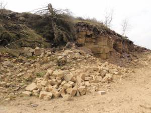 |
| Image 2 ID | 7318 Click image to enlarge |
| Image 2 Description | Unidentified trace fossils on surface of a quarried block. The linear tube like fossils are possibly roots of plants similar to mangroves. | 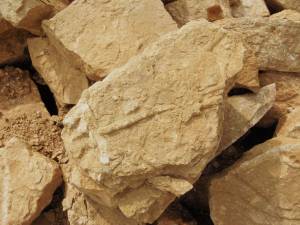 |
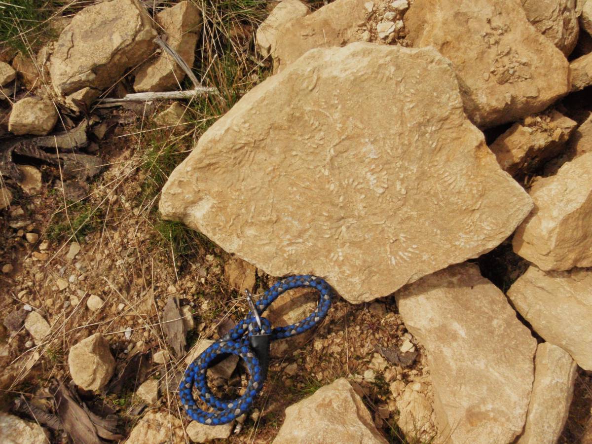
| Image 3 ID | 7317 Click image to enlarge |
| Image 3 Description | Unidentified small complex trace fossils on surface of a quarried block. Probably these small trace fossils are of different parts of the same plants as the linear fossils on image 2 above. |  |